
What does drone imaging add that manned aerial imaging doesn’t?
Drone imaging shares the same underlying camera and sensor technology used in manned aerial mapping, but changes the economics of when and how often that imagery can be captured. A drone can be deployed for a small field, a single construction site, or a single inspection target without the cost and logistics of a manned aircraft mission, and it can be flown again days or weeks later to track change over time in a way that would be impractical to repeat with a full aerial survey.
What is multispectral imaging, and why does it matter for agriculture?
Multispectral imaging captures image data across additional wavelength bands beyond what the human eye can see, most commonly adding near-infrared (NIR) data alongside standard color imagery. Phase One’s 4-band multispectral solution combines two synchronized aerial cameras, one capturing RGB color and one capturing NIR, mounted side by side and processed together to generate distortion-free, co-registered imagery. Adding that fourth NIR band to standard color data yields multispectral information that’s especially useful for vegetation studies, since healthy plant tissue reflects near-infrared light very differently than stressed or diseased tissue does, long before that stress becomes visible to the naked eye.
What can multispectral data actually reveal that color imagery can’t?
| Application | What multispectral (NIR + RGB) imaging reveals |
|---|---|
| Crop health monitoring | Early signs of plant stress, disease, or nutrient deficiency, often before visible symptoms appear. |
| Precision agriculture inputs | Variation across a field that can guide targeted irrigation, fertilization, or pesticide application. |
| Forestry and canopy studies | Fine-scale canopy features and vegetation regrowth patterns following events like storms or wildfire. |
| Environmental monitoring | Vegetation health indicators relevant to contamination studies and green-space monitoring in urban areas. |
How fast is demand for drone-based agricultural imaging growing?
The pace of adoption in this specific niche has been striking. Mordor Intelligence’s agriculture drones market research values the category at $1.5 billion in 2025, projected to grow to $3.9 billion by 2031, a compound annual growth rate of 16.72%, driven by rising labor costs, increasing agrochemical prices, and government support for precision agriculture. Falling hardware costs are part of that story too, with entry-level drones now available for a few thousand dollars, putting aerial data collection within reach of far smaller operations than would have been feasible even a few years ago.
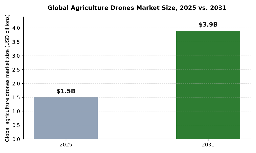
Global agriculture drones market size, 2025 versus 2031, according to Mordor Intelligence.
What does a drone imaging payload actually need to deliver?
- High resolution at operational altitude, so ground sample distance stays fine enough to support the analysis a mission actually needs.
- Reliable co-registration between bands, so RGB and NIR data line up pixel-for-pixel rather than requiring manual correction after the flight.
- Compact size and weight, since a drone’s payload capacity directly limits flight time, range, and which aircraft can even carry the sensor.
- Fast, automated processing, so a mission’s output is usable quickly rather than requiring extensive manual post-processing before anyone can act on it.
What vegetation indices can be derived once multispectral data is in hand?
Raw NIR and RGB bands become far more useful once they’re combined into indices that summarize plant condition in a single, comparable number. The most common of these is the Normalized Difference Vegetation Index (NDVI), calculated from the contrast between near-infrared reflectance, which healthy vegetation reflects strongly, and red-light reflectance, which chlorophyll absorbs. The resulting index gives agronomists a quick, field-wide way to spot stressed or thinning areas without inspecting every plant individually, and to compare the same field’s condition across different flight dates over a growing season.
| Index | What it highlights |
|---|---|
| NDVI (Normalized Difference Vegetation Index) | General vegetation vigor and biomass; the most widely used index for crop health screening. |
| Excess Green Index (visible-only) | A rough vegetation indicator usable from standard RGB imagery when NIR data isn’t available. |
| Soil-Adjusted Vegetation Index (SAVI) | Vegetation vigor with reduced sensitivity to exposed soil, useful in early growth stages with sparse canopy cover. |
| Canopy coverage mapping | The proportion of a field actually covered by vegetation, useful for stand-establishment assessment. |
How often should a field or forest actually be re-flown?
There’s no single right answer, since the ideal flight frequency depends on how quickly the condition being monitored can actually change. Fast-moving concerns, an active pest outbreak or irrigation failure, justify flights every few days during the critical window. Slower-moving concerns, like general seasonal crop development or annual forest health assessment, are often adequately served by monthly or seasonal flights instead. Flying more often than a condition can meaningfully change mostly adds cost and data-processing overhead without adding much decision-useful information, which is worth weighing against the appeal of simply collecting as much data as possible.
Frequently Asked Questions
Is multispectral imaging only useful for agriculture?
Agriculture is the most common application, but multispectral imaging also supports forestry health monitoring, environmental contamination studies, and green-space monitoring in urban planning, anywhere vegetation condition matters and isn’t fully visible in ordinary color imagery.
Do all drone imaging payloads capture multispectral data?
No. Many drone imaging payloads capture only standard RGB color imagery, which is sufficient for general mapping and visual inspection. Multispectral capability is typically a purpose-built addition for applications specifically needing vegetation or health-related analysis.
Why does co-registration between RGB and NIR bands matter so much?
If the RGB and NIR images aren’t precisely aligned pixel-for-pixel, the resulting multispectral analysis can misattribute a vegetation signal to the wrong physical location, undermining the accuracy of whatever decision the imagery is meant to support.
How often can drone imaging realistically be repeated over the same site?
Considerably more often than manned aerial surveys, since drone missions cost less and require less logistical coordination. Many precision agriculture programs fly the same fields on a regular schedule throughout a growing season to track change over time.
