The nature of modern conflict is increasingly urban. From dense city centers to sprawling residential blocks, the future battlefield is a labyrinth of concrete, steel, and glass. For military forces, particularly those with extensive experience in this domain like the Israel Defense Forces (IDF), it is understood that the “fog of war” is never thicker than when waged in a city. Here, threats are three-dimensional—coming from rooftops, windows, street level, and subterranean tunnels simultaneously.
Traditional situational awareness (SA) solutions, designed for open terrain, falter in this environment. GPS signals are blocked by urban canyons, lines of sight are counted in meters, and the line between combatant and non-combatant is perilously blurred. To master this complex battlespace, a new generation of interconnected situational awareness solutions is not just an advantage; it is a fundamental necessity for mission success and soldier survival.
The Urban Challenge: A Multi-Layered Problem
Achieving a clear operational picture in an urban setting requires overcoming several immense challenges:
- Vertical & Subterranean Complexity: Threats are not confined to a single plane. Snipers can occupy high-rise buildings while enemy fighters use tunnels to bypass defensive positions, creating a truly 360-degree battlespace.
- Degraded Communications: Dense construction materials block or reflect radio-frequency signals, making consistent communication and data transfer exceptionally difficult. GPS-denied environments are the norm, not the exception.
- Information Overload: The urban environment is saturated with “noise.” A multitude of sensors can overwhelm commanders and soldiers with raw data, making it difficult to distinguish a genuine threat from benign civilian activity.
- Compressed Decision Cycles: Engagements occur at extremely close quarters, drastically reducing the time available to orient, decide, and act (the OODA loop).
The Technological Ecosystem for Urban Dominance
The solution is not a single piece of hardware but a networked ecosystem of systems that collect, process, and disseminate actionable intelligence in real-time. The key pillars of this modern SA architecture include:
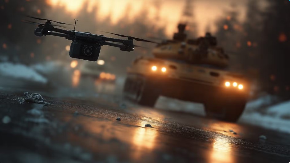
1. Pervasive, Multi-Domain Sensing: The foundation of SA is data, collected from a web of interconnected sensors. This includes persistent surveillance from high-altitude UAVs, tactical intelligence from small quadcopters that can peer into windows, and reconnaissance from Unmanned Ground Vehicles (UGVs) sent to scout ahead. Critically, it incorporates the “soldier as a sensor,” using body-worn cameras and smart devices to stream real-time information back to the network, turning every squad into a mobile intelligence-gathering unit.
2. AI-Powered Sensor Fusion: The sheer volume of data collected would be overwhelming without artificial intelligence. AI-powered fusion engines are the brains of the operation. They ingest thousands of disparate data points—video feeds, acoustic gunshot detections, drone locations, soldier biometrics—and intelligently correlate them in time and space. The AI’s role is to filter the noise, identify patterns indicative of a threat (like a potential ambush), and push only the most critical, relevant alerts to commanders and soldiers.
3. Advanced Visualization and C4I: How the information is displayed is as important as the information itself.
- For the Commander: The command post utilizes a dynamic, 3D Common Operating Picture (COP). This is not a flat map, but a detailed, living 3D model of the urban area, showing friendly “blue force” locations, suspected enemy positions, and live sensor feeds in a single, intuitive interface.
- For the Soldier: The most revolutionary leap is bringing this intelligence directly to the dismounted soldier via Augmented Reality (AR) headsets. Within their field of view, a soldier can see digital icons marking the real-time location of their squad mates through walls, view the video feed from a nano-drone clearing the room ahead, or see a warning marker on a suspected IED—transforming raw data into life-saving instinct.
4. Resilient, Ad-Hoc Networking: None of this is possible without a robust communications network. Mobile Ad-hoc Networks (MANETs) are essential. In a MANET, every soldier’s radio and every vehicle acts as a node in a self-forming, self-healing mesh. If one node is lost or blocked, the data automatically finds a new path, ensuring the SA ecosystem remains connected even when GPS and satellite communications are unavailable.
Ultimately, mastering the urban battlefield is a challenge of mastering information. By fusing data from every available sensor and delivering curated, actionable intelligence directly to the warfighter, these advanced situational awareness solutions are turning the chaos of the city into a transparent battlespace. For forces operating on the cutting edge of defense technology, this is how the urban fog of war is finally being lifted.