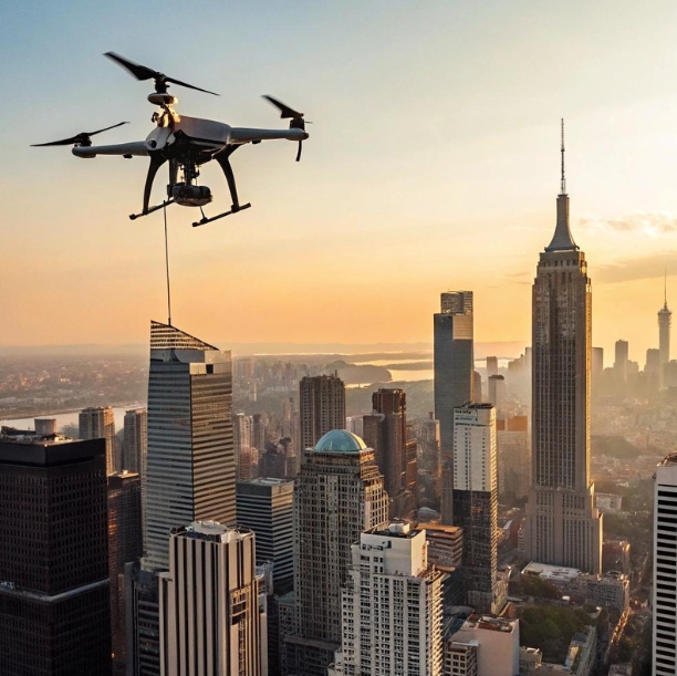
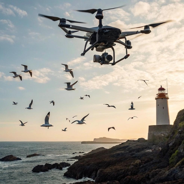
A flock of seagulls scatter as a drone rises from a rocky coastline, its lens locking onto a distant lighthouse. In a single sweep, it captures a cinematic, razor-sharp image that would’ve taken hours—and a helicopter—to achieve a decade ago. Welcome to the modern era of high resolution aerial photography, made possible by the innovation of advanced drone payload systems. These flying imaging platforms are no longer just tech gadgets; they are tools of precision, storytelling, science, and security.
The magic isn’t just in the drone’s flight—it’s in what it carries.
Zoom Without Shake: Why Resolution Needs Stability
Many assume high-resolution means a larger image file or more pixels, but clarity at altitude depends as much on stability as it does on sensor specs. A 100MP sensor mounted on a shaky or poorly balanced drone won’t deliver results any better than a mid-range smartphone strapped to a kite.
This is where gimbals and stabilization systems enter the equation. The best drone payloads integrate mechanical stabilization, real-time correction algorithms, and vibration dampening that keep the camera perfectly level even in wind gusts or during fast maneuvers.
These tools make it possible to shoot at slow shutter speeds, use optical zoom, or capture long-exposure photos—all from hundreds of feet above ground. It’s stabilization, not just sensor quality, that enables professional-grade imagery from a moving, airborne platform.
Payload Chemistry: Mixing Sensors for Mission-Specific Shots
Not every drone flies with a single purpose or camera. In fact, some of the most impressive drone missions today involve sensor fusion—where RGB cameras, LiDAR, and thermal imagers are flown together to create rich, layered datasets.
In agriculture, combining a standard visual camera with a multispectral sensor allows operators to compare chlorophyll levels to visible plant stress. In conservation, drones equipped with both infrared and high-resolution RGB sensors can monitor wildlife movements and habitat changes simultaneously.
The ability to mix and match payloads—thanks to modular mounting systems and payload bays—turns a drone into a Swiss Army knife of imaging. It allows operators to create customized sensor “cocktails” depending on the mission, from urban planning to pipeline inspection.
Achieve mission efficiency with modular drone payload combinations built for diverse imaging objectives.
Drone Payloads Aren’t Just Cameras Anymore
While cameras dominate the conversation around aerial photography, drone payloads have expanded far beyond just optical sensors. Drones are now being outfitted with air quality monitors, radiation detectors, methane sensors, loudspeakers, and even LED matrix displays.
These payloads don’t just capture images—they interact with the environment, enhance imaging context, or even alter outcomes. For example, pairing a high resolution camera with a methane sensor allows energy companies to visually pinpoint leaks in real-time.
In search and rescue operations, some drones carry thermal sensors and deliver emergency supplies. In media, drones are starting to carry light rigs to supplement cinematic scenes from above. It’s this versatility in payload function—not just imagery—that makes drones indispensable tools.
Pixels vs. Purpose: How Much Resolution Do You Really Need?
More pixels don’t always mean more value. While 150MP drone cameras are now available, the truth is that high resolution aerial photography should be matched to the mission’s actual needs.
Mapping a remote canyon might require ultra-high resolution to produce detailed 3D models, but filming a wide aerial establishing shot for a commercial could benefit more from dynamic range and color depth than sheer pixel count.
Resolution is closely tied to ground sample distance (GSD)—which measures how much area each pixel represents. At lower altitudes, a 20MP camera may deliver better ground detail than a 50MP sensor flying at 3x the height.
Understanding what the image is meant to do—measure, inspire, detect, archive—helps define how much resolution is “enough.” This clarity ensures payloads are not over-engineered (or overpriced) for the job.
Balance cost, weight, and clarity by choosing the right drone payload resolution for your operational goals.
Skyweight: How Payload Impacts Flight Physics
Every gram matters when you’re airborne. One of the most important considerations in drone-based photography is how payload weight affects performance—particularly flight time, speed, and battery efficiency.
Heavy cameras drain batteries faster, reduce maneuverability, and can even throw off a drone’s balance. That’s why today’s manufacturers are racing to develop lightweight, high-resolution sensors that deliver quality without compromising endurance.
Newer payloads are leveraging carbon fiber mounts, compact lens systems, and advanced chipsets to reduce power draw. At the same time, drone models are evolving to support heavier payloads without sacrificing performance, thanks to improved propulsion systems and energy-efficient designs.
Operators must calculate total takeoff weight (including the payload, gimbal, and attachments) and factor in environmental conditions such as altitude and wind. Ignoring payload physics can mean the difference between a smooth 20-minute shoot or a drone that drops out of the sky.
Cinema in the Sky: When Photography Becomes Storytelling
Aerial photography isn’t just about data—it’s also about drama. In film and media, drone payloads have given storytellers new ways to capture scale, emotion, and movement.
Filmmakers now use drones carrying full-frame cinema cameras, complete with prime lenses and onboard RAW recording. These systems capture breathtaking shots once limited to cranes or helicopters—and at a fraction of the cost.
Features like 4K and 8K capture, cinematic color grading, and high frame rate recording are all payload-dependent. When these tools are paired with skilled piloting, the sky truly becomes a canvas.
Directors no longer need to choose between agility and image quality. With modern drone payload systems, they get both—plus programmable flight paths, subject tracking, and smooth tilt/pan transitions for complex, choreographed scenes.
The Data Avalanche: Managing 100-Megapixel Aerial Shoots
A high-resolution image is beautiful, but 1,000 of them? That’s a data problem. One of the hidden challenges of high-resolution aerial photography is managing the volume of data generated by modern drone payloads.
RAW files from a 50MP or 100MP sensor can easily exceed 100MB each. Multiply that by the number of images needed for photogrammetry, orthomosaics, or continuous video capture, and you’re suddenly dealing with terabytes of data.
That data must be offloaded, backed up, and processed using high-performance computers. Many drone operators now use edge-computing payloads that pre-process imagery in the air, reducing file sizes and upload time.
Geotagging, file organization, and metadata management become crucial. This workflow complexity means that the job doesn’t end when the drone lands—in some ways, that’s when the real work begins.
Flying Smarter: AI, Autonomy, and Smart Payloads
What if your drone could not only take the photo, but decide when to take it? AI-powered payloads are making that possible. Smart cameras can identify subjects, track motion, and even avoid obstacles—all without pilot input.
Some multispectral payloads now use onboard AI to detect crop diseases. Others spot construction errors or powerline faults and mark them for follow-up—all in real time.
These advances reduce human error, increase data consistency, and streamline post-production. In time-critical missions like disaster assessment or search and rescue, this kind of smart autonomy can save lives.
The future of high resolution aerial photography is not just clearer—it’s more intelligent.
Conclusion: The Payload Is the Point
Drones are powerful tools—but without the right payload, they’re just flying machines. The camera, sensor, or toolkit attached to the belly of that drone defines its purpose, performance, and potential.
Whether you’re capturing the texture of a cathedral’s roof from 300 feet up or analyzing crop health across 500 acres, the success of your mission depends on how smartly your drone is equipped.
As payloads become more modular, lightweight, and intelligent, they will continue to transform what’s possible in the skies. For professionals in cinematography, agriculture, inspection, or conservation, choosing the right drone payload is more than a technical detail—it’s the key to unlocking the full potential of high resolution aerial photography.
The sky isn’t the limit. It’s just the beginning—if you know what to carry when you get there.
FAQs About Drone Payloads and Aerial Photography
1. What is a drone payload and why does it matter?
A drone payload refers to any equipment the drone carries during flight, such as cameras, sensors, or other tools. It directly influences what the drone can do, from capturing high-quality imagery to detecting environmental changes.
2. How does a drone payload affect flight performance?
Payload weight impacts flight time, battery consumption, and maneuverability. Heavier payloads reduce endurance and may require more powerful drones or optimized flight planning.
3. What qualifies as high resolution aerial photography?
High resolution aerial photography typically refers to imagery with fine ground sample distance (GSD), captured using high-megapixel sensors that provide sharp, detailed images suitable for inspection, mapping, or media.
4. Can drones carry multiple payloads at once?
Yes, many professional drones support dual or modular payload setups. This allows operators to combine cameras, LiDAR, thermal sensors, and more for comprehensive data collection.
5. What are the best drones for high-resolution photography?
The best drones have strong payload capacity, advanced stabilization, and compatibility with professional-grade cameras.
6. Do I always need the highest megapixel camera available?
Not necessarily. The required resolution depends on your project. For detailed inspection or 3D modeling, higher resolution may be needed, but for basic visuals, a 20–30MP camera may be sufficient.
7. How do I manage large files from high-res drone cameras?
Use high-speed storage cards, plan for fast offloading, and organize files with metadata and geotags. Specialized software like Pix4D or Adobe Lightroom helps with sorting and processing.
8. Can I upgrade the payload on my current drone?
If your drone supports modular payloads, yes. Many commercial drones allow swapping cameras or sensors, while consumer models often have fixed payloads.