If you’ve ever looked at a detailed satellite image of a city, traced the grid of streets, noticed the tiny parked cars, or spotted the shadows of buildings stretching eastward in the morning sun, you were looking at the outcome of a complex technological dance—one that begins with the camera.
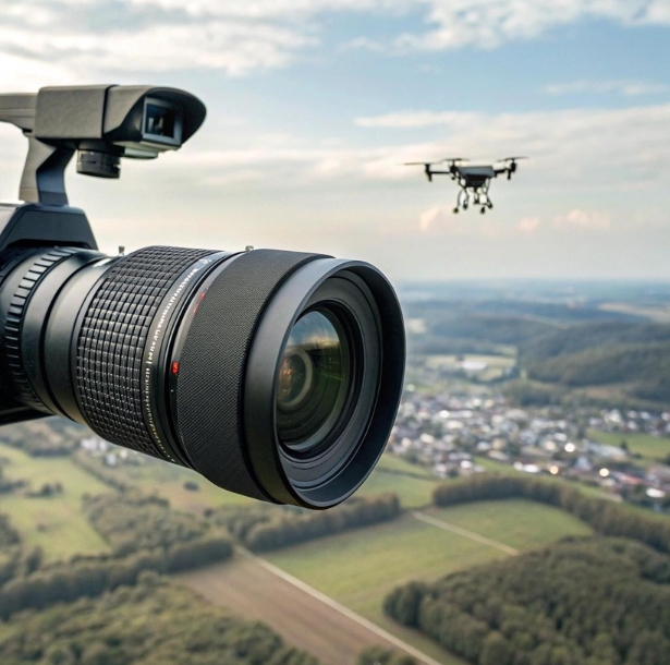
High resolution cameras are the unsung heroes of modern geospatial imagery. The sophistication of satellites and drones gets a lot of the spotlight, but without the right optics capturing every square meter in exquisite detail, we’d be navigating the world with little more than blurry outlines and best guesses. These cameras have redefined what we can see from above—and by extension, what we can know.
Organizations that rely on geospatial imagery need high resolution cameras to avoid guesswork and act with certainty.
Beyond Pretty Pictures
Not long ago, mapping involved boots on the ground, tape measures, and months of manual surveying. Today, camera tech lets us fly over a landscape once and come away with a complete digital twin. Roads, trees, rooftops—even construction zones and utility poles—are mapped with centimeter-level precision. The key difference? The sharpness and sensitivity of the imaging hardware. Better cameras mean more reliable insights, which has raised the bar across urban planning, environmental science, agriculture, disaster response, and more.
This isn’t just about taking prettier pictures. High resolution means more than aesthetic clarity. It’s the foundation of accurate measurement. If you’re an engineer inspecting a bridge, a farmer assessing crop health, or a city planner designing public transport routes, the ability to “zoom in” digitally without losing definition can make or break a project. Detail equals confidence.
Spectral Vision: Seeing What We Can’t
The most advanced camera systems today aren’t just capturing visible light. They’re built to see what we can’t—with spectral sensors that span thermal, near-infrared, shortwave IR, and beyond.
Why does this matter? Because different wavelengths of light tell different stories. A multispectral image of a forest might reveal which trees are healthy and which are diseased. A thermal image of a city block might expose which buildings are leaking heat. In agriculture, hyperspectral cameras can detect changes in crop health days or weeks before symptoms appear to the naked eye.
These applications rely on camera tech that’s not just sharp—but tuned for specific spectral bands. Without high resolution cameras that can adapt to these needs, much of this insight would remain invisible.
The Importance of Perspective
Camera tech doesn’t work in isolation. It’s influenced heavily by where it sits—whether on a satellite, a crewed aircraft, or a drone. Each has a role to play, and each requires a different kind of optical design.
Drones are the low-altitude champions of detail. Flying under cloud cover and above tree lines, they can capture sub-centimeter images ideal for construction monitoring, asset inspection, and local planning. Aircraft offer regional coverage with a blend of sharpness and area mapping, often used for infrastructure surveys or pipeline inspections. Satellites—while farther away—excel at broad, repeatable coverage. Their high resolution cameras must account for atmospheric distortion and lighting challenges, while still delivering crisp, usable data from hundreds of kilometers away.
Matching the right platform with the right camera system is what turns raw pixels into useful geospatial imagery.
When the Camera Thinks for You
Another major leap in recent years has come not from the lens itself, but from what’s behind it. High resolution cameras are now often paired with real-time onboard processing—AI chips that analyze, classify, and even interpret the image before it’s downloaded.
This edge computing capability means a drone can fly over a flooded area and identify blocked roads or stranded people in real time. A satellite can flag changes in terrain or unauthorized construction immediately after capture. The combination of smart algorithms and crystal-clear imagery reduces the time between “data acquired” and “decision made.”
As geospatial imagery grows smarter, high resolution cameras play a vital role in feeding clean, reliable data to the systems that interpret it.
Data Becomes Actionable
Clarity doesn’t just make images look nice—it makes them measurable. That’s the whole point of geospatial technology: transforming physical landscapes into data layers.
From a single flight, a high-end camera can produce an orthomosaic, a 3D surface model, a vegetation index map, and an object count—all automatically extracted from pixels. Want to measure the amount of green space in a neighborhood? Count the trees in an orchard? Monitor road wear across a highway network? It all starts with the resolution of the source image.
Low-resolution cameras might miss subtle slope changes, surface cracks, or minor land deformations. High resolution cameras catch them—and make them measurable.
Telling Stories from the Sky
Beyond technical applications, high-resolution imagery also plays a human role—documenting how people live, where they move, and how the planet changes. Activists and journalists have used satellite images to reveal illegal mining, refugee camp growth, war damage, and environmental destruction.
These stories need more than distant, blurry visuals. They need clarity—imagery so detailed it speaks for itself. That clarity depends on cameras designed to see the world as it is, with minimal distortion and maximum integrity.
Geospatial imagery has become a tool not just for analysis, but for truth-telling.
The Data Dilemma
But all this clarity comes at a cost. High resolution imagery creates a flood of data. A single aerial survey can generate hundreds of gigabytes—sometimes terabytes—of raw photos, models, and metadata.
That means storage challenges. Processing demands. Transmission bottlenecks. In some cases, data must be compressed or prioritized in real time, depending on urgency and bandwidth. For organizations using satellites or BVLOS (beyond visual line of sight) drones, edge compression and cloud offloading are essential parts of the workflow.
And then there are the privacy concerns. With enough resolution and frequency, you’re no longer just mapping buildings—you’re watching people. Regulatory standards are still catching up to the ethical implications of 30-centimeter imagery that can track vehicles, crowds, or even individuals.

Into the Fourth Dimension
The future of geospatial imagery isn’t just higher resolution or better sensors—it’s temporal. That means capturing not only what a place looks like, but how it changes over time.
Some camera systems now support real-time imaging for high-frequency revisit schedules. This opens the door to live mapping: updating models in near real time, tracking infrastructure as it’s built, or watching landscapes change seasonally, daily, even hourly.
Eventually, geospatial data will be four-dimensional by default—capturing space and time. And the only way to make that future viable is with camera systems that are fast, reliable, and incredibly sharp.
The Camera Behind the Curtain
In the age of satellites, drones, and AI-powered dashboards, it’s easy to forget the role of the lens. But behind every insight, every image, every decision, there’s a camera doing the hard work of seeing clearly.
High resolution cameras are not just the starting point of geospatial imagery—they’re the gatekeepers of its quality. Without them, the data is compromised. With them, we unlock a sharper understanding of the world around us—one frame at a time.
Frequently Asked Questions
1. What is geospatial imagery used for?
Geospatial imagery is used for mapping, monitoring, and analyzing Earth’s surface. It’s applied in urban planning, agriculture, environmental monitoring, disaster response, and more. The data helps organizations make location-based decisions with accuracy and confidence.
2. Why are high resolution cameras important in mapping?
High resolution cameras provide the clarity needed to capture fine details in geospatial imagery. The sharper the image, the more reliable the measurements. This precision is critical when you need to assess infrastructure, track changes over time, or make decisions based on surface-level features.
3. Can regular cameras be used for geospatial imagery?
Not really. Geospatial work requires cameras designed for accuracy, stability, and often spectral sensitivity beyond visible light. These specialized systems also include geotagging, calibration, and compatibility with data processing tools—things consumer cameras simply don’t offer.
4. What resolution is considered “high” for geospatial cameras?
It depends on the application and platform. For drones, resolutions down to 1–3 centimeters per pixel are common. For satellites, high resolution generally means 30–50 centimeters per pixel or better. In all cases, the goal is to capture small, meaningful features clearly.
5. How do spectral sensors enhance geospatial imagery?
Spectral sensors allow cameras to see beyond visible light—like infrared or thermal bands. This unlocks insights that human vision can’t detect, such as plant stress, heat loss, or material composition. They’re essential in fields like agriculture and environmental science.
6. What are the trade-offs of using high resolution imagery?
More resolution means more data—bigger files, longer processing times, and heavier storage demands. There are also privacy and ethical considerations when imagery gets sharp enough to track people or vehicles in real time.
7. Do satellites offer better imagery than drones?
Not necessarily. Satellites cover more ground and revisit locations frequently, but drones can fly lower and deliver higher detail. The right tool depends on your needs—broad trends or fine detail.
8. Can AI analyze geospatial imagery from high resolution cameras?
Yes, and it’s becoming more common. AI systems can classify land use, detect objects, and track changes over time. High resolution images improve AI accuracy by providing cleaner data to work with.