Reshaping Geospatial Data Acquisition
The demands for highly detailed, expansive geospatial data are escalating rapidly, pushing the boundaries of traditional surveying methods. In this new era of hyper-accurate data collection, a truly transformative tool has emerged: the payload drone. This advanced aerial platform, specifically engineered to carry sophisticated sensors, is fundamentally enabling large format mapping with unprecedented efficiency, detail, and cost-effectiveness. It’s a synergy that is not just improving existing processes but entirely reshaping how industries acquire and utilize comprehensive spatial information, promising a future where detailed maps are accessible for virtually any large-scale project.
Understanding the Payload Drone in Mapping
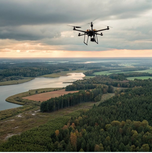
At its core, a payload drone, in the context of professional mapping, is an Unmanned Aerial Vehicle (UAV) specifically designed with significant lifting capacity and stability to carry heavy, specialized sensing equipment. Unlike smaller, consumer-grade drones, these platforms are robust, often featuring multiple rotors and advanced navigation systems that ensure stable flight even with substantial weight onboard. This design is critical because the high-resolution cameras, LiDAR scanners, and other advanced sensors required for detailed mapping are often weighty and demand a steady platform for accurate data capture.
The key characteristics that make a payload drone ideal as a mapping carrier include extended flight durations, allowing for the coverage of larger areas in a single sortie; precise flight path programming capabilities, ensuring systematic and repeatable data collection; and, crucially, a dependable lifting capacity that can accommodate cutting-edge multi-sensor arrays. These drones are engineered to maintain a stable altitude and consistent speed, which is paramount for minimizing data distortion and ensuring the geometric accuracy of the captured imagery and point clouds. Their ability to execute pre-planned missions autonomously further enhances efficiency and consistency across expansive mapping projects.
Ultimately, the payload drone acts as an airborne extension of the surveyor’s toolkit, able to access areas safely and efficiently that might be difficult or dangerous for human ground crews or less effective for manned aircraft. Their versatility in mounting various types of sensors transforms them into multi-purpose data acquisition platforms, adaptable to a wide range of mapping requirements, from agricultural analysis to complex civil engineering surveys.
Defining Large Format Mapping
Large format mapping refers to the process of acquiring geospatial data over extensive geographical areas, typically requiring high resolution, exceptional accuracy, and significant detail across a broad scope. This isn’t just about taking aerial photos of a few acres; it involves systematically collecting comprehensive data for sprawling urban environments, vast stretches of agricultural land, lengthy infrastructure corridors like pipelines or power lines, or expansive environmental regions. The output is usually a highly detailed, georeferenced dataset, such as an orthomosaic (a geometrically corrected aerial image), a dense 3D point cloud, or elevation models.
Traditionally, achieving large format mapping involved considerable logistical challenges. It often required expensive manned aircraft, which are limited by weather conditions, flight restrictions, and high operational costs. Ground-based surveys, while accurate, are incredibly time-consuming and resource-intensive for large areas. The inherent challenge has always been to achieve both broad coverage and high fidelity simultaneously, without compromising one for the other.
Industries that heavily rely on large format mapping include urban planning and development, where accurate models of entire cities are needed for zoning, infrastructure projects, and smart city initiatives. Agriculture benefits from large-scale health monitoring and yield prediction. Environmental studies utilize it for deforestation tracking, geological surveying, and disaster assessment. Infrastructure monitoring, covering vast networks of roads, railways, and utilities, also relies on this capability for maintenance planning and digital twin creation.
How Payload Drones Revolutionize Large Format Mapping
The true revolution in geospatial data acquisition lies in the synergy between the robust capabilities of a payload drone and the demanding requirements of large format mapping. This is where the carrying capacity, extended endurance, and precise flight control of the payload drone directly enable efficient and unprecedentedly detailed large format mapping that was previously difficult or cost-prohibitive.
Unlike smaller drones limited to lightweight cameras and short flight times, payload drones can carry heavier, professional-grade sensors that capture more data per flight. This means that a single payload drone can cover significantly larger areas in a shorter amount of time than multiple flights with lesser drones or prolonged ground surveys. This efficiency translates directly into reduced operational costs and faster project completion times. The ability to cover vast territories in fewer flights also ensures greater data consistency, as environmental conditions and lighting are less likely to change significantly during the acquisition phase.
This combination effectively overcomes many of the limitations of traditional methods. Manned aircraft, while capable of large-scale coverage, are expensive to operate, require significant lead time, and cannot fly at the low altitudes necessary for ultra-high-resolution data capture. Ground surveys, while offering high precision, are painstakingly slow and can be unsafe or impossible in certain terrains. The payload drone offers a flexible, cost-effective, and safe alternative that bridges the gap between these traditional methods, providing the speed of aerial capture with the detail approaching ground-level precision for extensive areas. This allows for truly transformative approaches to collecting and analyzing large format geospatial data.
The Eyes of the Payload Drone
The effectiveness of a payload drone in large format mapping hinges on its ability to integrate and precisely operate a diverse array of advanced sensors, which serve as its “eyes” for data acquisition. The lifting capacity and stable flight characteristics of these drones are paramount for accommodating these sophisticated instruments, ensuring they capture accurate and usable data.
Among the most common and powerful sensors is LiDAR (Light Detection and Ranging). LiDAR scanners emit laser pulses and measure the time it takes for them to return, creating highly accurate 3D point clouds of the terrain and objects. This is invaluable for generating precise elevation models, bare-earth mapping (penetrating vegetation), and detailed infrastructure inspection. High-resolution RGB cameras are also standard, capturing millions of pixels to create incredibly detailed orthophotos (geometrically corrected aerial images) that serve as foundational base maps for various applications.
Beyond these, payload drones can carry multispectral or hyperspectral sensors, which capture data across specific light wavelengths beyond what the human eye can see. These are crucial for applications in agriculture (monitoring crop health, identifying stress), forestry (species identification, disease detection), and environmental analysis (water quality, land cover classification). Thermal cameras, another valuable payload, detect heat signatures, useful for inspecting solar panels, identifying heat loss in buildings, or locating hot spots in wildfires. The stability of the drone platform and its precise navigation system are critical for ensuring that data from these sophisticated instruments is captured consistently and accurately, enabling the creation of highly detailed and reliable large format mapping products.
Precision, Accuracy, and Data Quality
In large format mapping, the integrity of the data hinges on absolute precision and accuracy. The combination of a stable payload drone platform and advanced georeferencing technologies ensures that the resulting geospatial data is of the highest quality, minimizing errors and maximizing reliability for downstream analysis and decision-making. Achieving this level of precision requires more than just high-resolution sensors; it demands meticulous positional data.
Modern payload drones integrate advanced Global Navigation Satellite System (GNSS) technology, often employing Real-Time Kinematic (RTK) or Post-Processed Kinematic (PPK) capabilities. RTK/PPK GNSS systems receive corrections from ground-based reference stations, allowing the drone to determine its position with centimeter-level accuracy in real-time or during post-processing. This pinpoint georeferencing ensures that every pixel in an orthophoto or every point in a LiDAR cloud is precisely located on the Earth’s surface, eliminating the need for numerous ground control points and significantly reducing fieldwork time.
The stability of the payload drone during flight is also paramount for data quality. Vibration isolation systems and advanced flight controllers ensure that the sensors remain steady, preventing blurring in imagery and maintaining the geometric integrity of the collected data. This combination of highly accurate positioning and stable data capture means that the output from a payload drone engaged in large format mapping is reliable enough for demanding applications like engineering design, volume calculations, precise asset management, and regulatory compliance. High-quality data reduces the risk of costly errors in subsequent phases of a project, providing a trustworthy foundation for critical decisions.
Overcoming Traditional Mapping Obstacles
The advent of the payload drone for large format mapping has effectively dismantled many of the significant obstacles that have plagued traditional mapping methods for decades. Its inherent capabilities offer compelling advantages in terms of efficiency, safety, and overall cost-effectiveness when compared to methods like manned aircraft flights, helicopter surveys, or extensive ground-based surveying crews.
One of the most striking advantages is efficiency. A payload drone can be deployed rapidly, often within hours, and can complete mapping missions over large areas far more quickly than traditional methods. Manned aircraft require extensive planning, air traffic control clearances, and are limited by high operational costs and fuel consumption. Ground crews, while precise, are incredibly slow and labor-intensive for expansive projects. The drone’s ability to swiftly capture vast amounts of high-resolution data translates directly into reduced project timelines and quicker access to critical information, enabling faster decision-making and project progression.
Safety is another paramount consideration. Deploying a payload drone eliminates the need to put human personnel in potentially hazardous environments, whether it’s a steep slope, an active construction site, a dangerous industrial facility, or a disaster zone. The drone can access difficult or unsafe terrains remotely, collecting accurate data without risking human lives. This also contributes to significant cost savings by reducing labor hours, equipment costs associated with manned flights, and the often-prohibitive expenses of accessing remote or dangerous locations. By overcoming these traditional barriers, the payload drone effectively democratizes access to high-quality large format mapping, making it a viable and superior option for a broader range of industries and applications.
Evolving Technologies in Drone Mapping
The landscape of drone mapping is continuously evolving, with the payload drone at its forefront, promising even more profound advancements for large format mapping. The future frontiers of this technology are being shaped by breakthroughs in several key areas, pushing the boundaries of what is possible in geospatial data acquisition and analysis.
We can anticipate significant improvements in payload drone technology itself. This includes the development of drones with even longer flight times, achieved through advancements in battery technology, hydrogen fuel cells, or hybrid power systems. Increased autonomy, enabled by more sophisticated AI-powered navigation and obstacle avoidance systems, will allow drones to operate with minimal human intervention over even larger and more complex terrains. We may also see the integration of swarm intelligence, where multiple payload drones collaborate to map an area even more rapidly and efficiently.
Furthermore, sensor technology, the eyes of the payload drone, will continue to advance. Miniaturization will allow for even more powerful sensors to be carried by smaller drones, while new sensor types or improved capabilities (e.g., enhanced spectral resolution, deeper ground penetration for GPR) will emerge. Integrated data processing, often leveraging on-board AI acceleration, will become more powerful, allowing for immediate quality control and preliminary analysis directly in the field. These evolving technologies will make large format mapping even more precise, accessible, and versatile, cementing the payload drone’s role as an indispensable tool for future geospatial innovation in smart cities, environmental monitoring, and the construction of digital twins for the physical world.
The Sky’s the Limit for Geospatial Innovation
The journey from rudimentary aerial photography to sophisticated large format mapping, driven primarily by the capabilities of the payload drone, marks a monumental leap in how we understand and interact with our physical world. This powerful synergy provides an unparalleled combination of efficiency, precision, and accessibility in acquiring critical geospatial data, revolutionizing industries from urban planning to agriculture and infrastructure management.
By overcoming the limitations of traditional methods, offering superior data quality through advanced sensor integration, and ensuring remarkable scalability, the payload drone has become an indispensable tool. It transforms the challenges of comprehensive mapping into streamlined, cost-effective operations, yielding insights that were once either impossible or prohibitively expensive to obtain. As technological advancements continue to push the boundaries of endurance, autonomy, and sensor capabilities, the future role of the payload drone in driving geospatial innovation for large format mapping will only expand, truly making the sky the limit for what we can achieve in understanding our planet.
FAQs: Payload Drones & Large Format Mapping
1. What defines a payload drone in the context of professional mapping? A payload drone is an Unmanned Aerial Vehicle (UAV) specifically designed with significant lifting capacity and stability to carry heavy, specialized sensing equipment for professional mapping, rather than just basic cameras.
2. What is large format mapping, and what industries benefit from it? Large format mapping is the acquisition of geospatial data over extensive geographical areas with high resolution and accuracy. Industries like urban planning, agriculture, infrastructure monitoring, and environmental studies greatly benefit from this capability.
3. How do payload drones revolutionize large format mapping? Payload drones revolutionize large format mapping by enabling efficient coverage of vast territories in fewer flights, carrying professional-grade sensors, and overcoming limitations of traditional methods in terms of cost, time, and access.
4. What types of advanced sensors can a payload drone carry for mapping? A payload drone can carry various advanced sensors, including LiDAR for 3D point clouds, high-resolution RGB cameras for orthophotos, multispectral/hyperspectral sensors for environmental analysis, and thermal cameras for heat detection.
5. How do payload drones ensure high precision and accuracy in mapping data? Payload drones ensure high precision and accuracy through stable platforms, advanced GNSS technology like RTK/PPK for centimeter-level positioning, and minimal data distortion, which is crucial for reliable geospatial data.